Discover this new virtual experience: Malaga from a bird’s eye view!

It is very likely that there are many villages in the province of Malaga that not only you have never been to, but you have no idea what they are really like.
For this trip through the nine regions of Malaga you don’t need a ticket. It’s done at a click… and it’s free of charge.
With this new tool, very easy to use both on computer and mobile phone, you can discover the 103 municipalities of the province of Malaga from the air.
In addition, together with the photograph, points of interest of each town and its history are highlighted (for now only available in Spanish).
In this aerial viewer we can enjoy another very different perspective from which we can also appreciate very well the wonderful nature that surrounds many of these municipalities, especially those that are further away from the busy Costa del Sol.
Discover the regions of Malaga from a bird’s eye view
The aerial platform is divided into nine sections that make up the nine regions of the province of Malaga:
The Axarquía
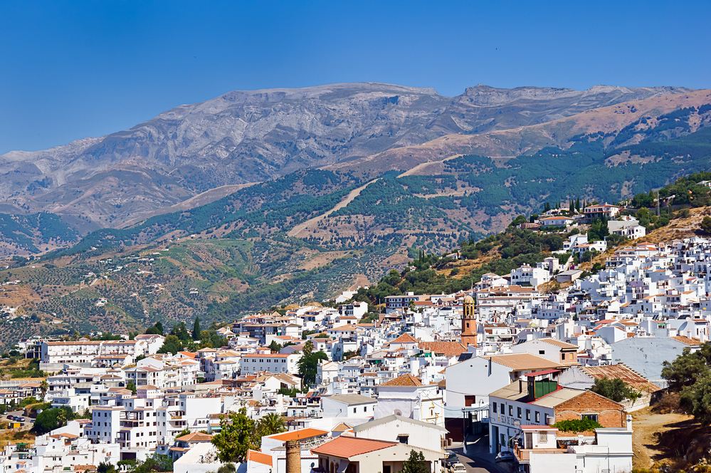
This is the easternmost region of Malaga, with the highest mountains in the province and its many beautiful white villages of Arabic origin.
Antequera
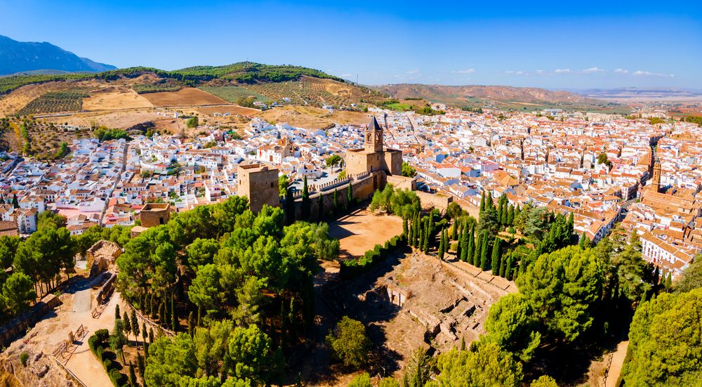
The region of Antequera, a historic and monumental city, which is also home to some impressive dolmen sites more than 5000 thousand years old.
And nature lovers should not miss El Torcal de Antequera, a karst labyrinth almost out of a fairy tale with two very easy routes for the whole family.
Guadalteba and Noroma
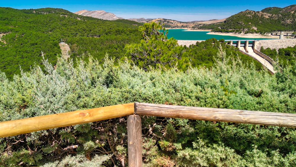
The inland regions of Guadalteba and Noroma with their villages nestled between mountains and crops are not very known yet, so you might want to discover more?
But quite surely you are familiar with the famous Caminito del Rey sitauted in the south of the Guadalteba valley!
Serranía de Ronda
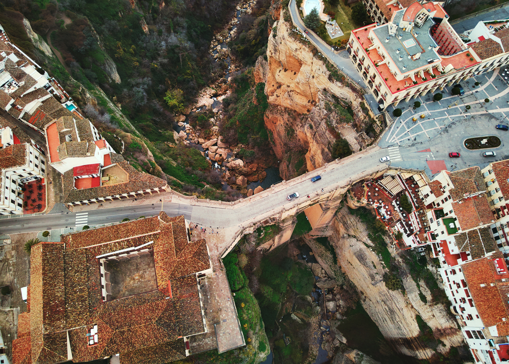
The beautiful Serranía de Ronda with its vast expanses of ancient forests, its charming white villages of Moorish origin.
And the famous historic and monumental city of Ronda that you should not miss on your visit to Malaga.
Sierra de las Nieves
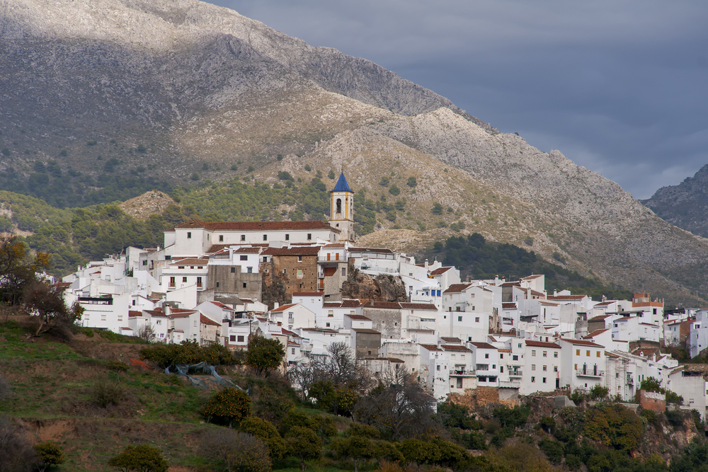
Another great unknown area, but a must for nature lovers is Sierra de las Nieves.
This area is home to the largest and oldest extension of Pinsapo forests. There is plenty of water and charming white villages to discover.
In case you didn’t know, Sierra de las Nieves has been declared two years ago as the first National Park in the province of Malaga. With this seal it has maximum environmental protection.
Guadalhorce Valley
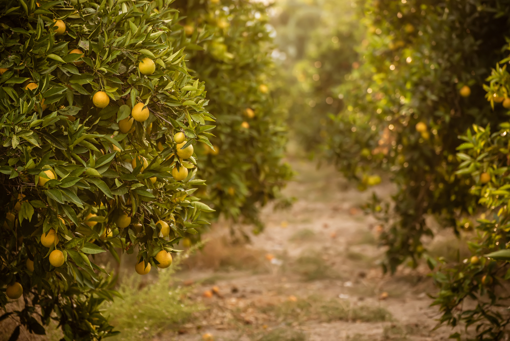
The Guadalhorce Valley is also known as the orchard of Malaga.
It takes its name from the river Gaudalhorce which with its flow irrigates the extensive citrus, fruit and vegetable crops.
The Valle de Abdalajís is also located in this area and is a popular spot for paragliding enthusiasts.
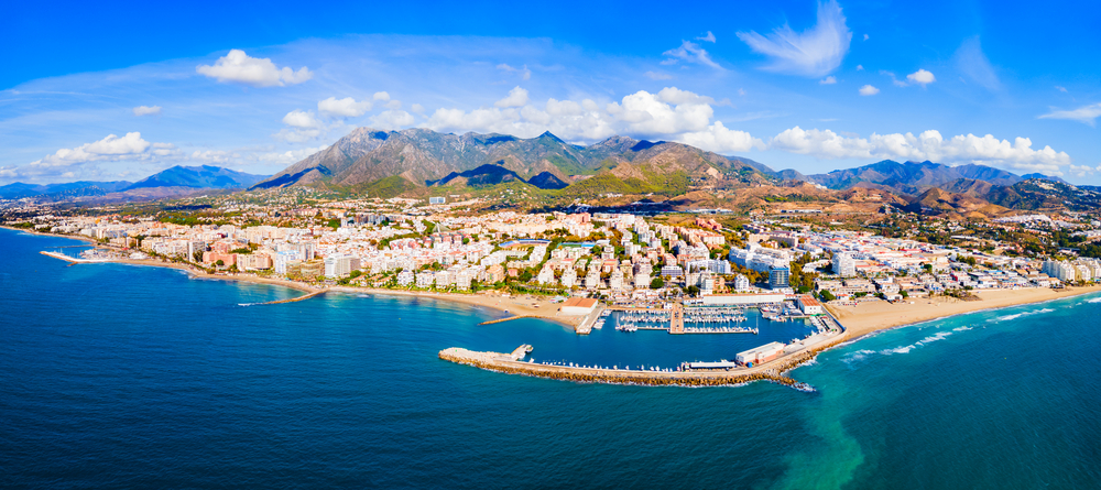
Costa del Sol
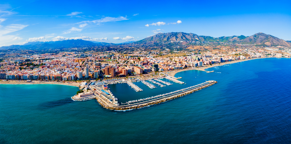
The most popular strip of Malaga is still the Costa del Sol, with its best-known towns such as Torremolinos, Marbella, Fuengirola and Estepona.
But you can also discover other more hidden gems such as Benahavís or Casares.
Malaga city

And finally, discover Malaga city from a bird’s eye view, its intrinsic streets, squares and monuments.
Virtual tour of Malaga from a bird’s eye view
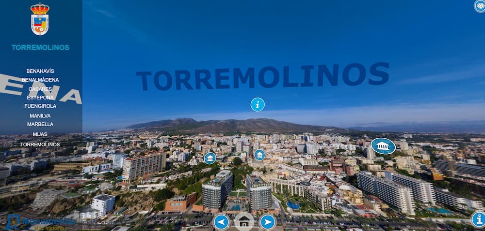
The tool is very simple to use. Once you have selected one on the home page, the application displays a drop-down menu with all the municipalities included.
Simply choose the one you want to fly over the town and access a 360-degree aerial image. Once opened, you select the town. You can play with the zoom and it even indicates how far away the nearest towns are.
Ideally, you should take the car and drive around the province’s 103 municipalities. But in the meantime, you can embark on a virtual tour of Malaga from a bird’s eye view.
And we almost bet that you’ll find places that capture your interest and that you’ll want to visit the next time you come to visit us. Thus, you can plan your trip a little.
Link to virtual tour of Malaga from a bird’s eye view, enjoy!